It’s quite a long way to Wales from Cambridge. It’s not so far that you have spend several days travelling to get there, the UK is, after all, quite small. It is far enough to be annoying to get to though. Getting anywhere from Cambridge used to be a lot worse than it is now (for non-native UK readers: the second most common conversation for Brits after the weather is about roads and traffic; we have a lot of that too). Unless you want to go North or South, there’s only one road in and out of Cambridge: the A14. It sounds innocuous. A-roads in this country are generally pretty good - but not this one, until recently that is. Several years of grindingly slow road works stretching 20-odd miles across Cambridgeshire finally came to completion during the SARS-CoV-2 pandemic. The punchline: you can leave Cambridge, and it doesn’t feel like pulling to teeth to do so.
That was an unnecessarily long intro, but an important one. The A14 is the reason we don’t normally go to Wales. With having not had a full week off work since Christmas and a lack of desire to take a plague flight overseas, we opted for a “stay-cation” (isn’t that just what our grandparents did for holidays anyway?!). Wales was our destination of choice, specifically South Wales, and even more specifically the Brecon Beacons and Pembrokeshire as neither Julie nor I had been there before (for our sins).
As with any journey, some planning is required. During which, for this particular one, it transpired that we would be crossing through the most densely populated areas of Wales. Practically what this actually means is that in an are the size of Yorkshire there are 11 different Welsh counties. Yes. 11. I really want to know why. It seemed silly not to stop off and try the county top of at least one.
Before I go any further I want to describe the main characteristics of Wales. It’s green, because it rains a lot, and it’s hilly, so it rains a lot.
Of the 11 possible counties to choose from just 3 of them fell below the magical threshold of 500m.
“Why 500 meters?”, I hear you cry. Because I’m too unfit to run up anything that high at the moment. That’s it. No excuses about living in the flattest part of the country (too easy to complain about), or working too hard so I don’t have time to train. Nope. I’m just too lazy at the moment.
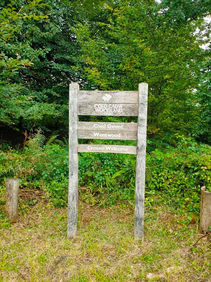
3 choices. Swansea, Cardiff and Newport. Both Cardiff and Swansea would have been quite long diversions to our journey (5 hours is more than enough driving for one day), so that just left Newport. My sum total knowledge of Newport is derived entirely from listening to Goldie Looking Chain back in the early 2000’s. Thankfully, the highest point in Newport county isn’t actually in Newport town. Seriously. Thankfully.
We pitched up at the Cadira Beeches car park at the top of the hill, popped into the trees for a cheeky wee, then set off on trails heading down hill. The first 2 miles were down and down and down. I think we even managed to clock the fastest miles on any of the county runs so far…by several minutes.
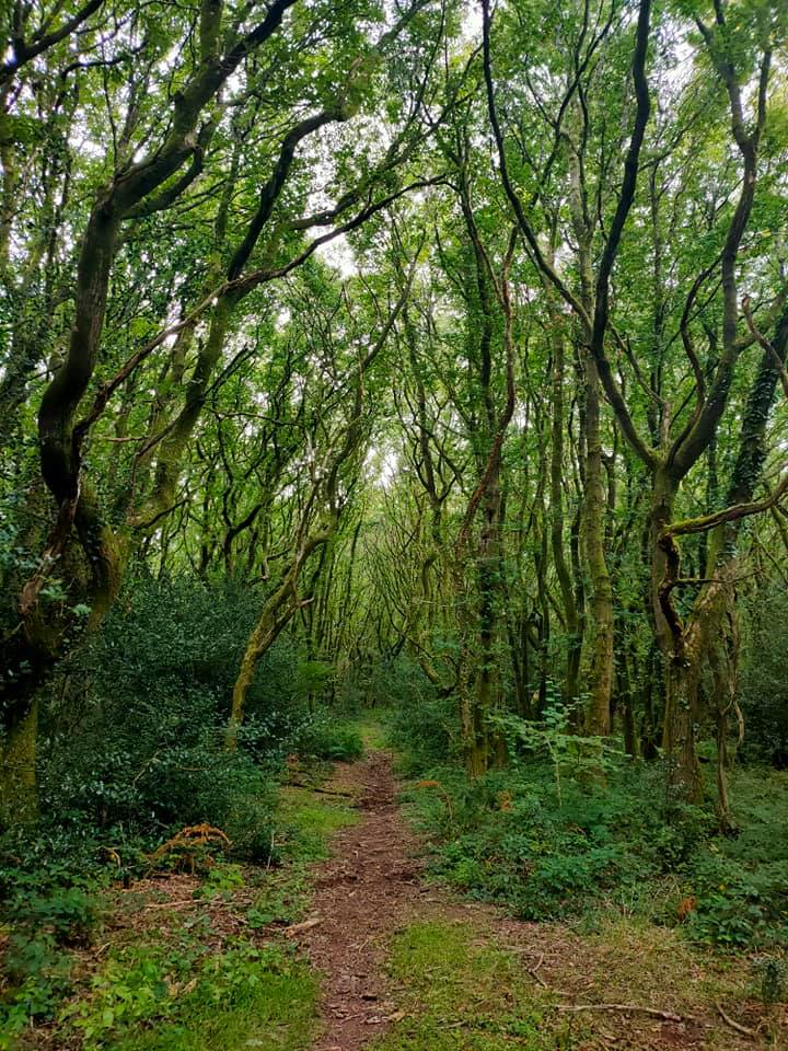
Another side note: I’m quite shit at micro-navigating when there are features and landmarks to use. Do you know what the features and landmarks are in a forest? There are none, you have to use the contours. That’s a pain because it means that the only way you know if you’ve gone wrong (other than changing direction), is that you are going up or down hill when you should be doing the opposite. That can make it pretty tiring when you’re a bit navigationally challenged like ones-truly.
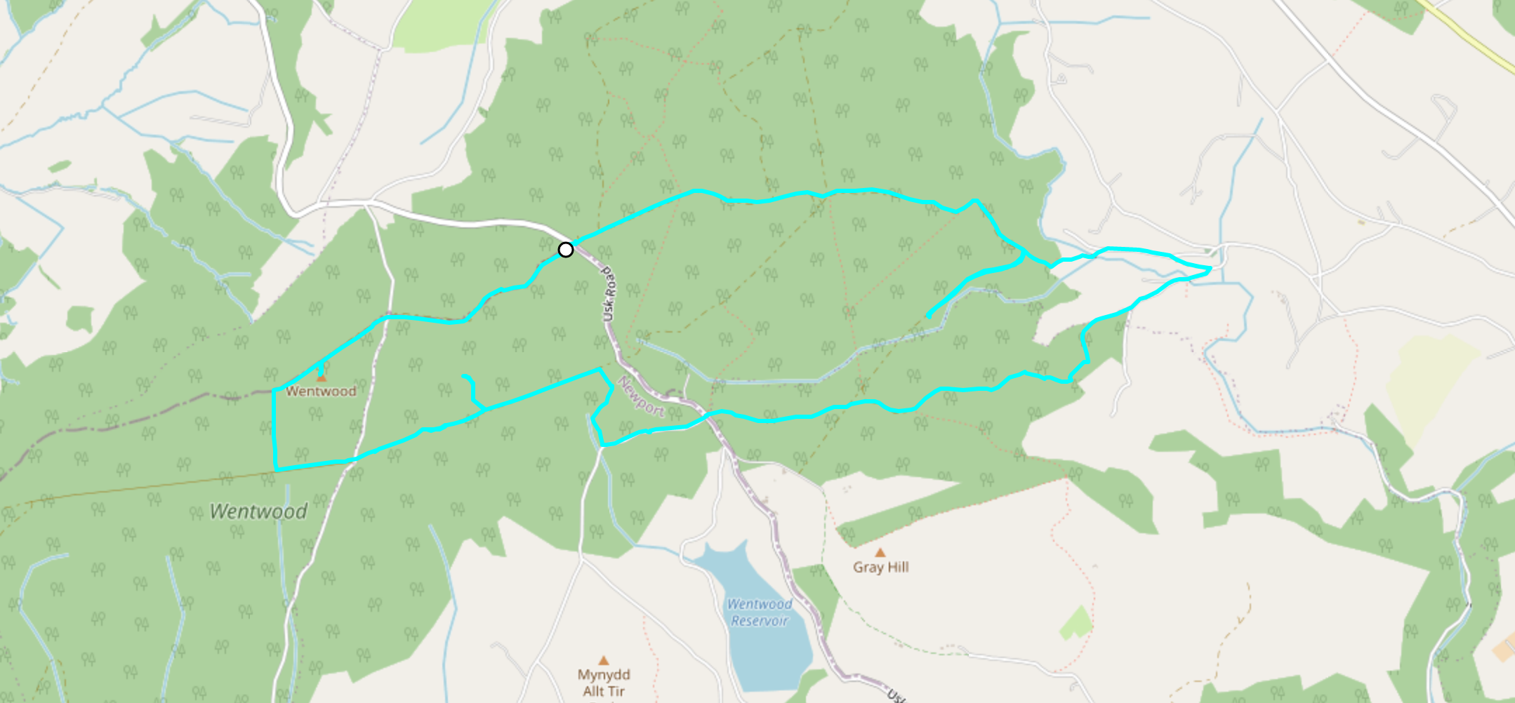
Cue the predictable navigational error. I want to claim mitigating circumstances here. We were running on wide hard packed forest trails. Big wide ones that can take lorries for carrying timber. On a map, the only marking that could indicate the difference in path size is, for instance, between a footpath and bridleway. Footpaths are, well for feet, i.e. pedestrians only, whereas bridleways are for bikes and horses, as well as walkers. By design, that means bridleways are bigger than footpaths. We can all agree on that? Not in Newport. No. The “bridleways” are the same size as the footpaths! And the horses use them. So when I was looking out for a bridleway for our route, I think I can be forgiven for ignoring the small gap in the bushes that was supposed to be a f*cking bridleway.
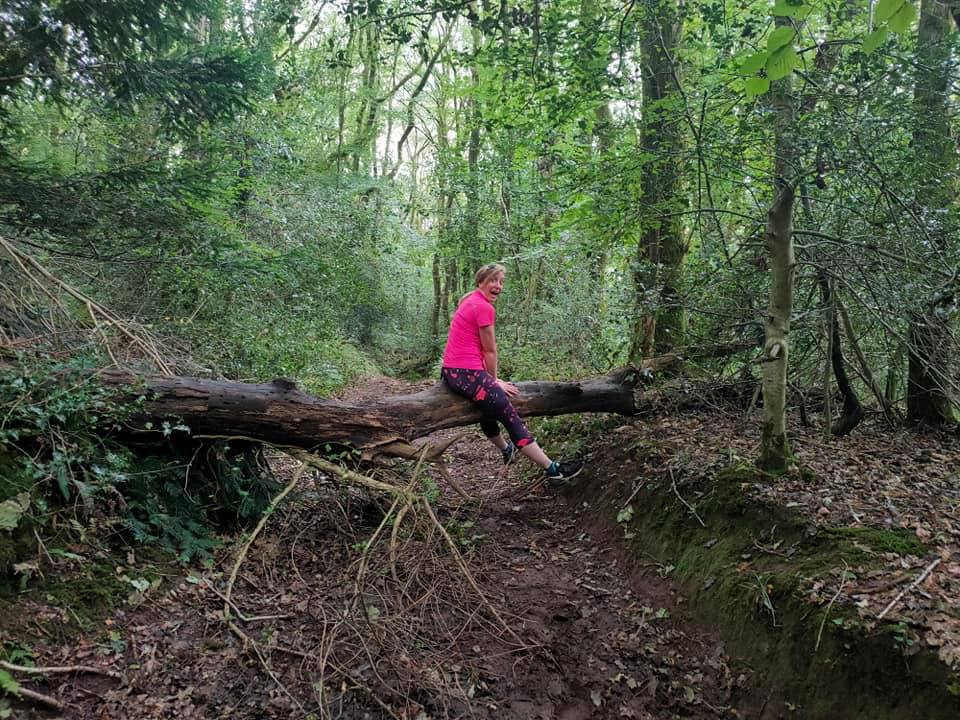
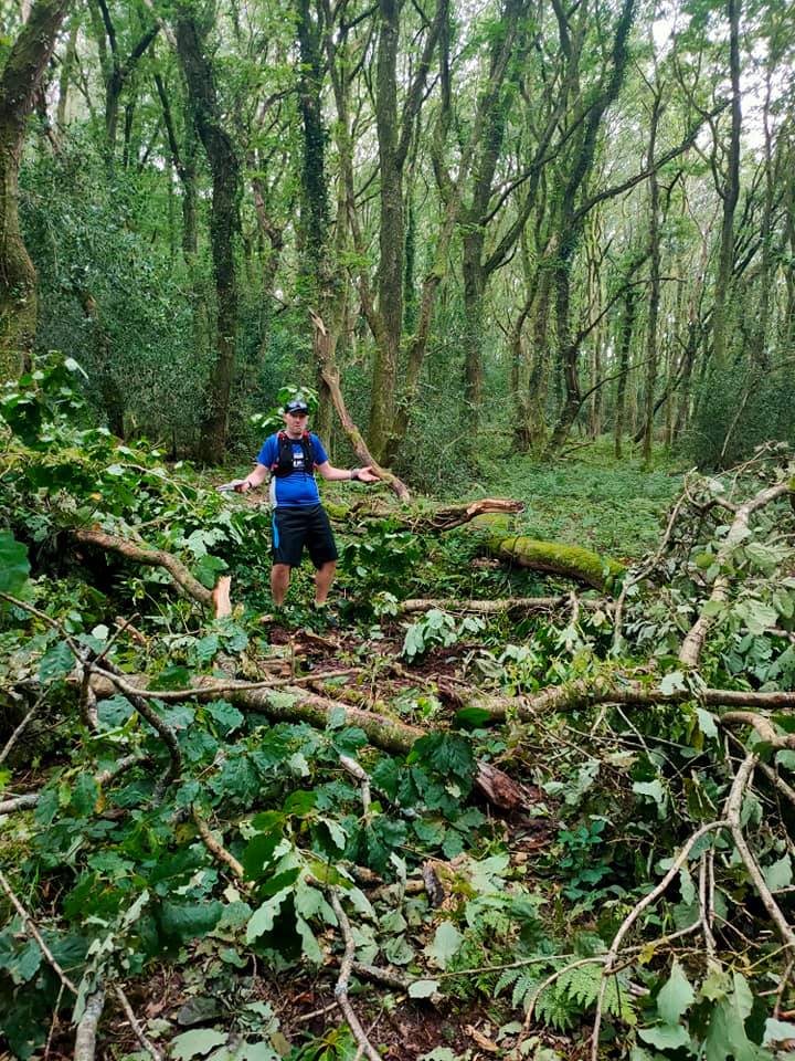
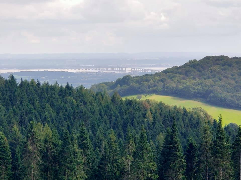
Getting back on track (ha! See what I did there?), we carried on down-hill (via a very small “bridleway”), surmounting one or two obstacles on our way (see photos below) to reach the bottom. We emerged into a pretty little valley, peppered with cottages and small farms, as we trotted along the small country lanes and began the slow climb back up the side of the hill. Passing through deciduous and pine trees, enjoyed the dappled sunlight, and occasional glimpses over the river Severn and all the way across to the Severn crossing.
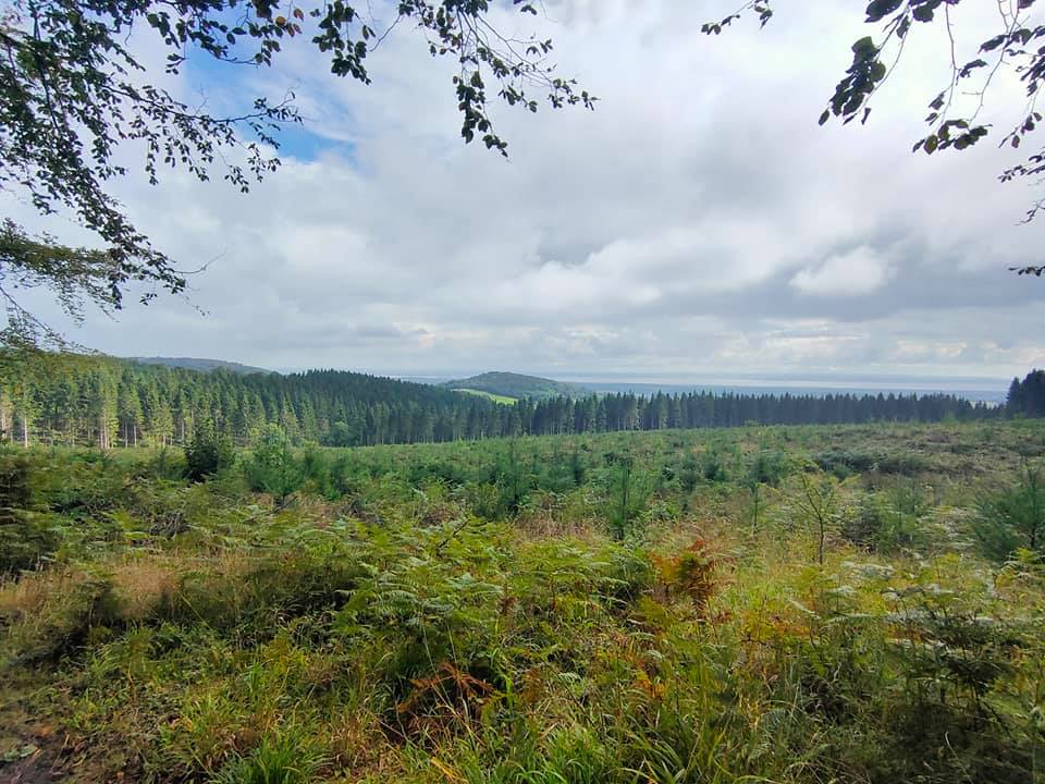
We were back on the forest trails now, and followed undulating tracks, that at times rose steeply to gain height, and tempted us with views down to Wentwood reservoir. At Foresters oak (and a reported tea room nearby), we crossed onto a country lane, before turning off up hill back onto forest tracks.
By this point we were flagging a little bit, and predictably made an error in judgement by following the wide forest trails that wound up-hill. My spidey-sense was tingly, and I realised our mistake as we reached the top of the rise. Sorry Julie, back down hill. This time I got annoyed. The track was supposed to follow a straight line, down hill in this case, and continue in an arrow-straight line. We duly ran down the rocky broken slope to the bottom, to be confronted with a bend in the path. I checked the map, nope, there shouldn’t be a bend here. Conclusion: we’d gone wrong again. Damn. I could have sworn we were going the right way. Okay, back up the hill again to the crossing. Consult the map. No, all of those paths are in the wrong direction. It must be the track we were just on.
The conclusion?
The map is wrong. [shocked gasps from the audience]. Either the surveyor couldn’t be bothered to put this bend on the map (granted it wasn’t massive, but it was definitely not straight), Ordnance Survey only map to a certain accuracy, or the map is wrong. I am a massive fan of the OS, I don’t want to question them - but if anyone knows the answer to this one I would be super grateful.
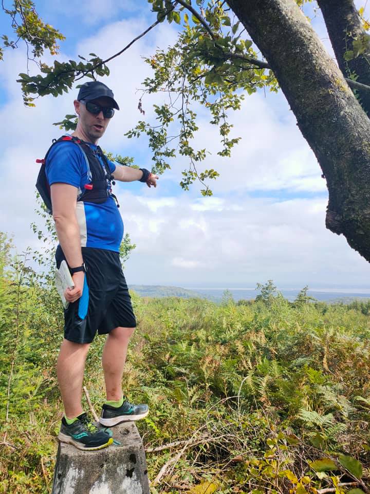
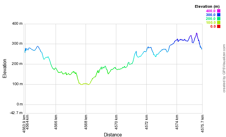
Back on track (that pun never tires) - we continued in a straight line, crossing over a metaled track. At this point we knew we had to go up at some point (we’d planned a particular junction), but we were also acutely aware that we had added on a kilometer or two here and there. Coupled with being a tad unfit and very hungry we figured that going up hill earlier than planned wouldn’t hurt, after all, it was still a solid mile from the high point to the car, and we were well over 5 1/2 miles in. We diverted up hill along a rutted track, gaining ~50 vertical meters in a little over 400 meters in distance. Joining the main bridleway, we turned right and ran until we found a little snick on the right that led to the (somewhat obscured) trig point. County number 20, in the bag. The customary summit selfies were taken, and we stopped a moment to appreciate the sweeping view all the way down to the river Severn, which was an unexpected bonus. Finally, we got back on the trail and followed the forest trails (with great suspicion), until we eventually emerged exactly where intend back at the car.
Finished.
What followed was a (mostly) glorious holiday involving gale-force winds that forced us to turn around whilst climbing Pen Y Fan (we’ll be back for you), christening our new inflatable kayak, and hiking along the Welsh coast path, spotting seals, gannets and Peregrine falcons. Absolute bliss.
South Wales is a-mazing. If you haven’t been, then you are sorely missing out.
Until next time.
Share this post
Twitter
Google+
Facebook
Reddit
LinkedIn
StumbleUpon
Email