County number 2
Hill 2: A confession
I have a confession to make. In my last post I told you that I had run up Great Chishill, that towering edifice of Cambridgeshire. I lied.
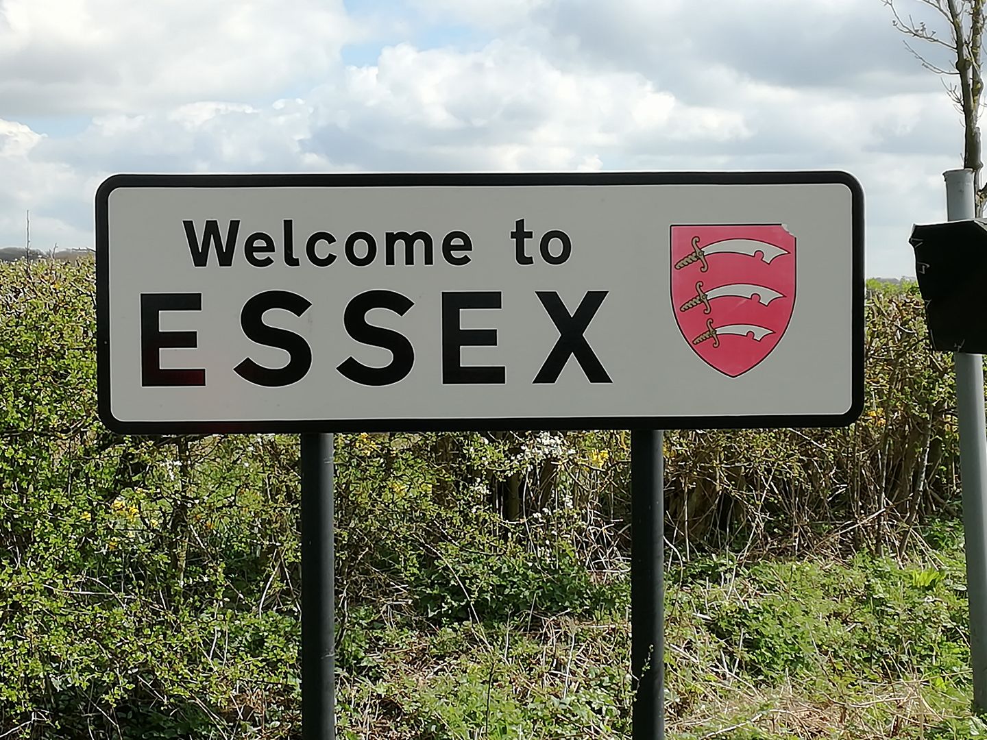
The hill in nearby Essex is called Chishill Common, and stands at a lofty 147m. Great Chishill is it’s little sister at 146m. They are both within a few miles of each other, so when I planned the route for my first foray into this project, I went looking for the highest point in that area. So basically I ran up the right hill, in the wrong county. Disaster averted, because today I ran up the real Great Chishill (which is still in Cambridgeshire)!
You can even see on the map (OS Explorer 194) just how close the two hills are. So close in fact, that the route today overlapped with a section Fred and I ran a fortnight ago (you can just make it out on the right hand side).
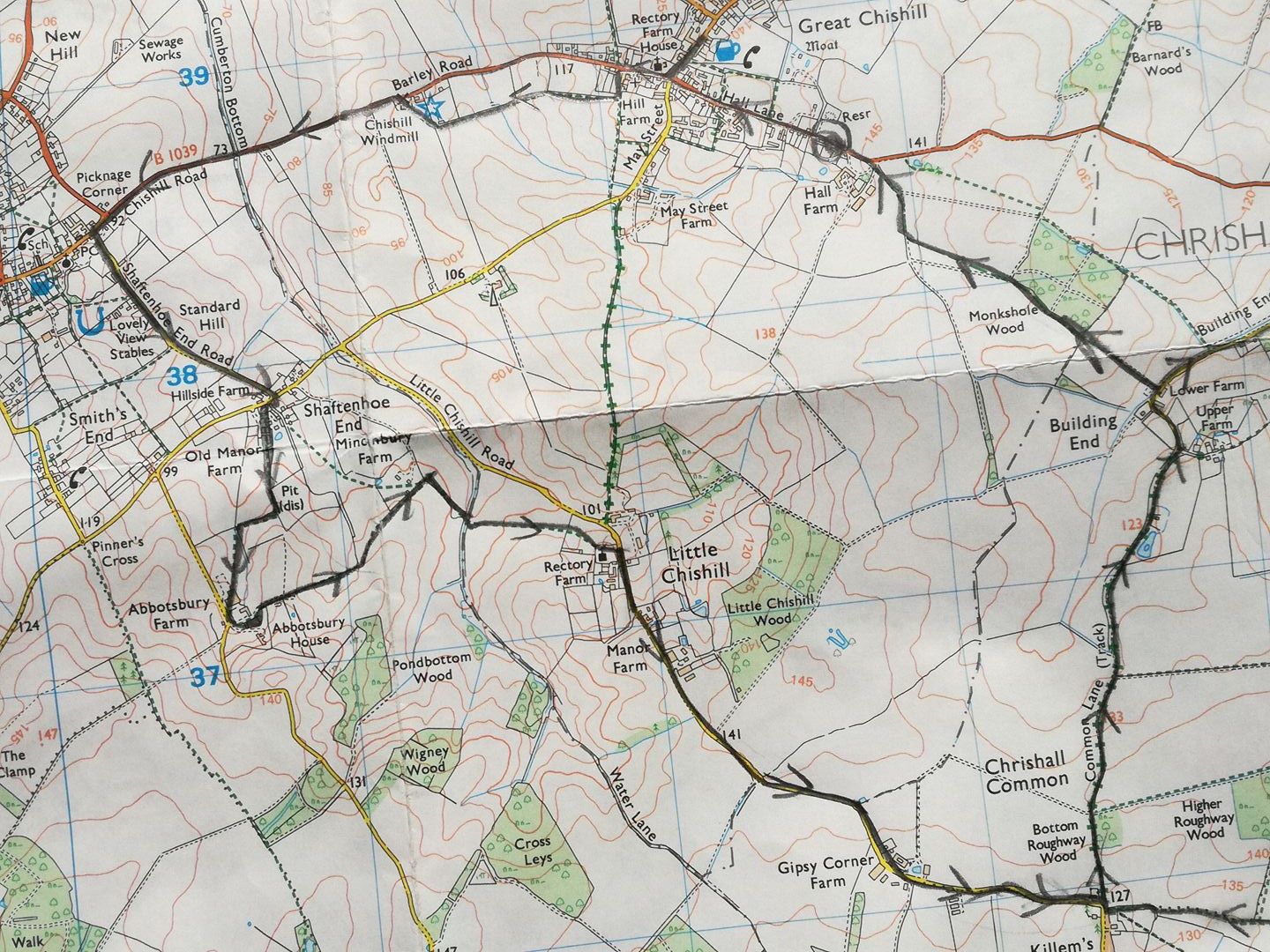
We started at another pub (of course), The Pheasent in Great Chishill and proceeded to run in the opposite direction to the hill; there’s no way I was getting cheated out of a decent 10km run by Cambridgeshire’s paucity of proper hills. All was going well, there was a bit more road than last time, but these were mostly on quiet country lanes. As we ran down through Shaftenhoe End Fred and I hit our first navigation decision, so we took what we thought was our preordained path to hilly glory. Well Abbotsbury House to be accurate. However, instead of taking the path we thought we were on, we actually managed to veer off left throwing us off course. Unfortunately we did not realise our error, and so continued to try to navigate around the farm, looking for a crucial footpath (we’d already run down it :-( ). What transpired was an exercise in futility, shockingly bad orienterring, and about a 3km detour. The extent of our futility was captured by Endomondo:
https://www.endomondo.com/users/3375171/workouts/898122913
Suffice to say we ended up heading in completely the opposite direction that we wanted, and much, much closer to the gun shots coming from the nearby estate. With help of modern technology (thanks Google Maps), we realised our mistake and got back to Abbotsbury House, and our intended path.
After that it was pretty uneventful, the weather was stunning, and there was very little wind. The course of the route crosses three county borders; Cambridgeshire, Hertfordshire and Essex, so I feel that we covered some good ground.
The only sting in the tail was the last bridelway to the village was rutted by tractors which made it harder going than the rather gentle incline would suggest. I also don’t think tacking on the extra 3km was helping particularly by that point!
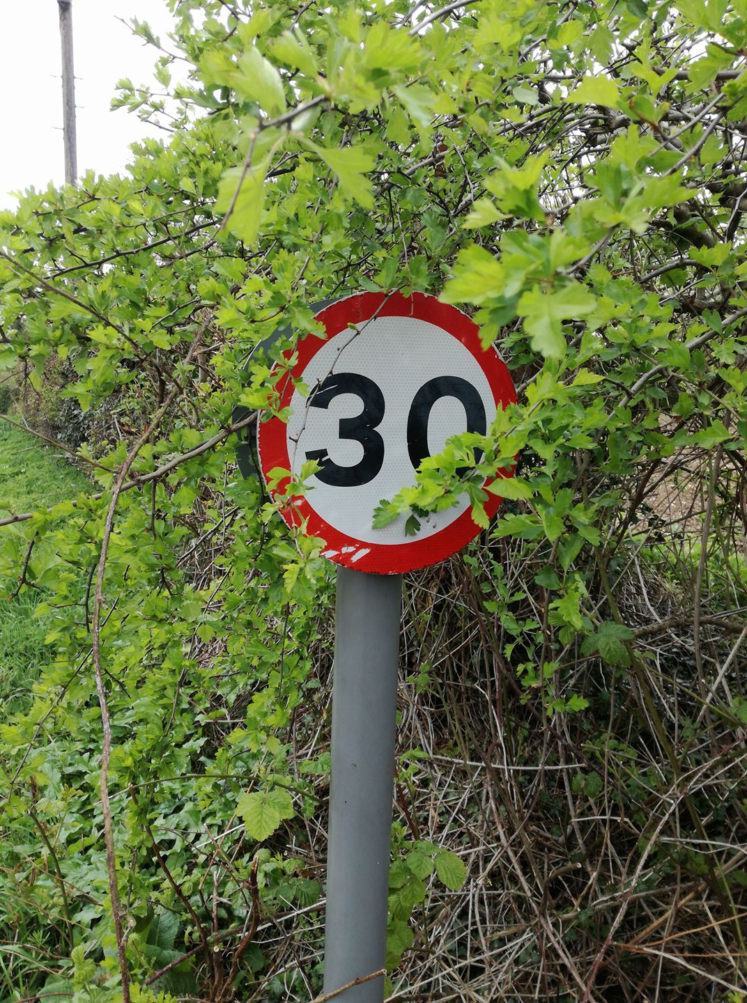
The whole route was definitely hillier than the first, which was partly intentional as the highest point in Cambridgeshire is unassumingly marked by a 30mph repeater sign. Anyone could miss that this is the point of greatest altitude in all of Cambridgeshire!
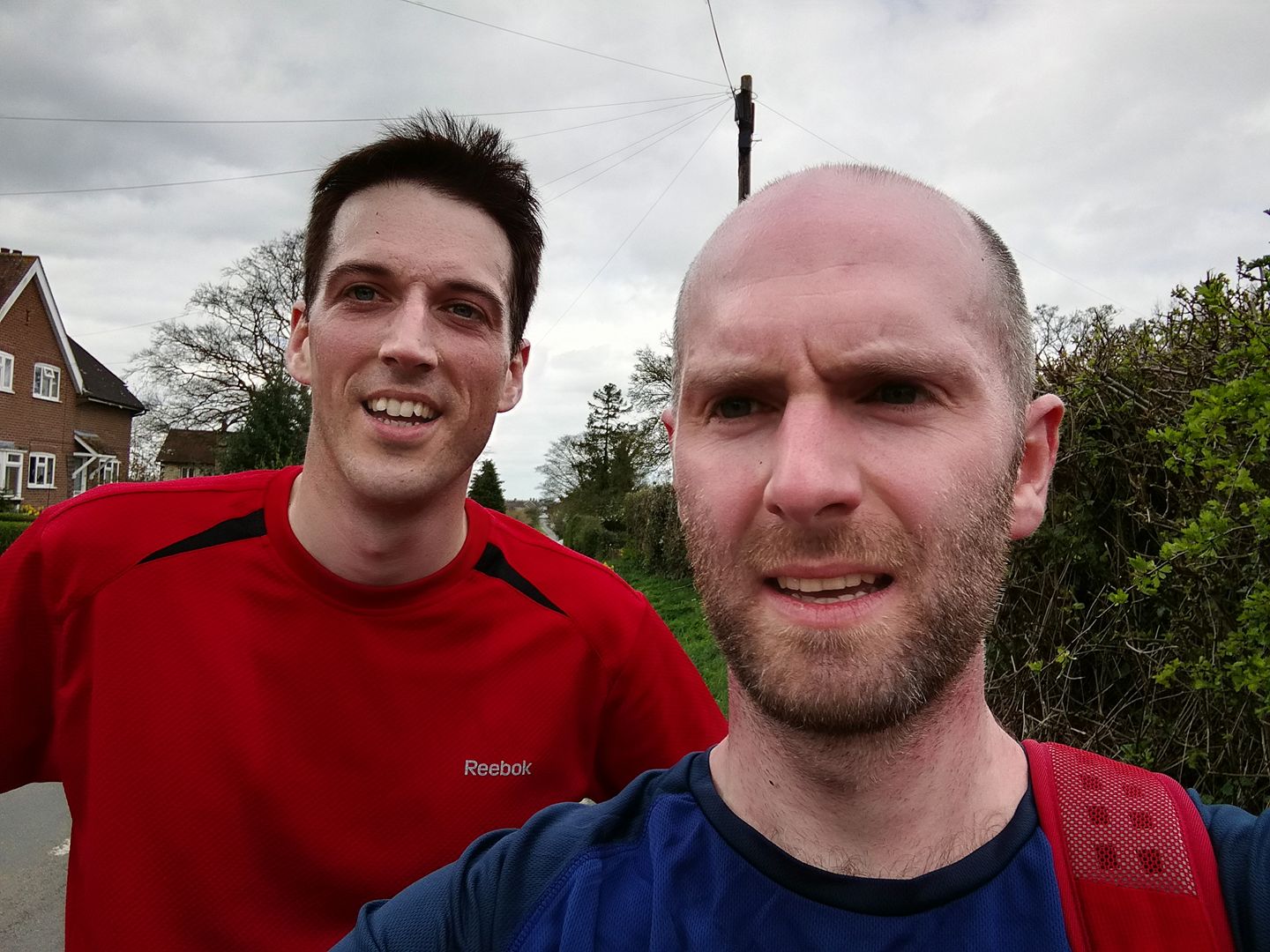
And proof that we were there of course.
This definitely felt like a bigger challenge than the previous route, as there were many more altitude (!) gains and descents. We rewarded ourselves with a (now) customary drink in the village pub, which felt more deserved as we tallied up 15km in total. I have to admit to being slightly proud of myself; this is the furthest I’ve run since my injury, and is a real confidence boost that I am well on the road to recovery. Fred and I even discussed turning one of these smaller challenges into a half marathon route, time will tell whether we do that or not.
As always there are lessons to learn. The first is to read my spreadsheet of hills properly. I don’t think there will be many more opportunities for this sort of stupid mistake. I am also going to start carrying a compass. I think we could have avoided the unnecessary navigational errors by just taking a bearing, and realising we were several hundred metres from our intended position. This will be especially important for the hills (mountains!) that come later that will not be so easy to navigate.
So, that’s 2 hills now, and pretty much the only ones within a 30 minute drive of Cambridge. The next highest hills are in Bristol, Mereseyside and Lincolnshire. I have to start venturing out into the country properly to start making headway with the others, which is also part of my motivation for doing this challenge.
On a side note, there are 3 hills smaller than the 2 I have run so far, and I need to decide how to incorporate them into a run. I think I can get to the hill in Suffolk and back in day, Norfolk is a bit trickier. I think I will struggle with motivation for these smaller hills, as they will definitely feel like less of an achievement, individually at least.
Share this post
Twitter
Google+
Facebook
Reddit
LinkedIn
StumbleUpon
Email